rareoldprints.com


Search

If you know the reference number
enter it here:


If you enter more than one word
it will be treated as phrase.

Insert "and" or "or" between words to search for the words in any order.

Refine your search here or build another search.
Displaying 10 to 20 of 88 - Next - Previous
94%
Britannia & Normandia cum confinib regionibus
Ref: P/28207
Region: Brittany
Type: Copper
Cartographer: Mercator G
Engraver: Hondius J
Date: 1595

Not for sale
94%
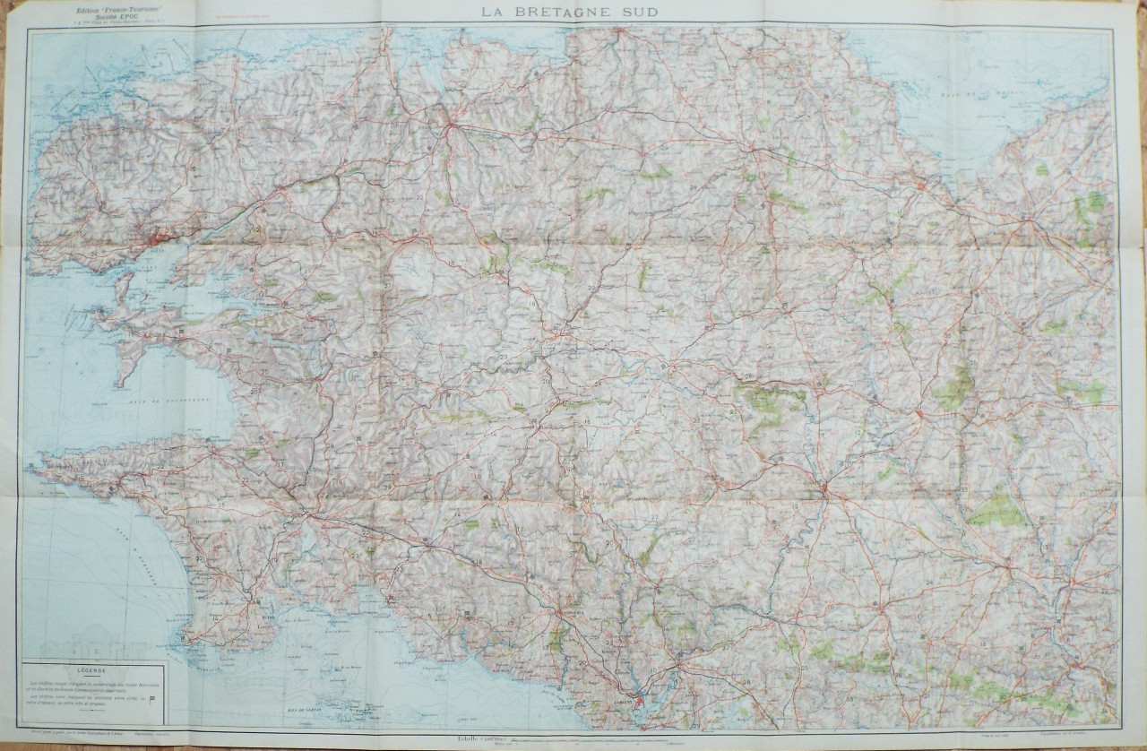
La Bretagne Sud. Carte Officielle du Service Geographique de l'Armee.
Ref: P/28165
Region: Brittany
Type: Chromo-lithograph
Date: 1930

94%
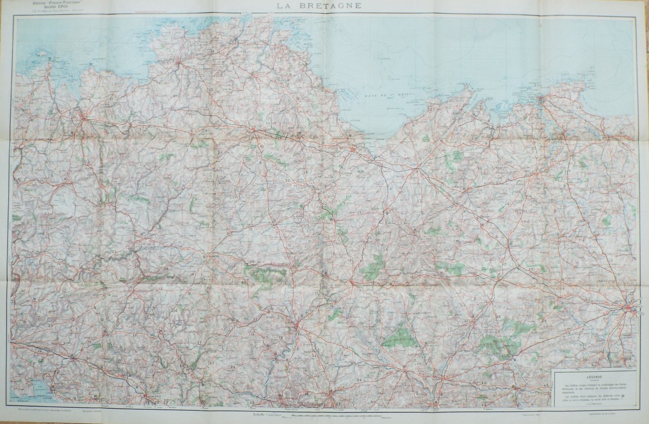
La Bretagne. Carte Officielle du Service Geographique de l'Armee.
Ref: P/28164
Region: Brittany
Type: Chromo-lithograph
Date: 1930

94%
A Map of the North Eastn. Part of the Province of Brittany
Ref: P/11366
Region: Saint-Malo
Type: Copper
Cartographer: Kitchin T
Engraver: Kitchin T
Date: 1758

93%
A Map of the North Eastn. Part of the Province of Brittany
Ref: P/5418
Region: Saint-Malo
Type: Copper
Cartographer: Kitchin T
Engraver: Kitchin T
Date: 1758

Not for sale
92%
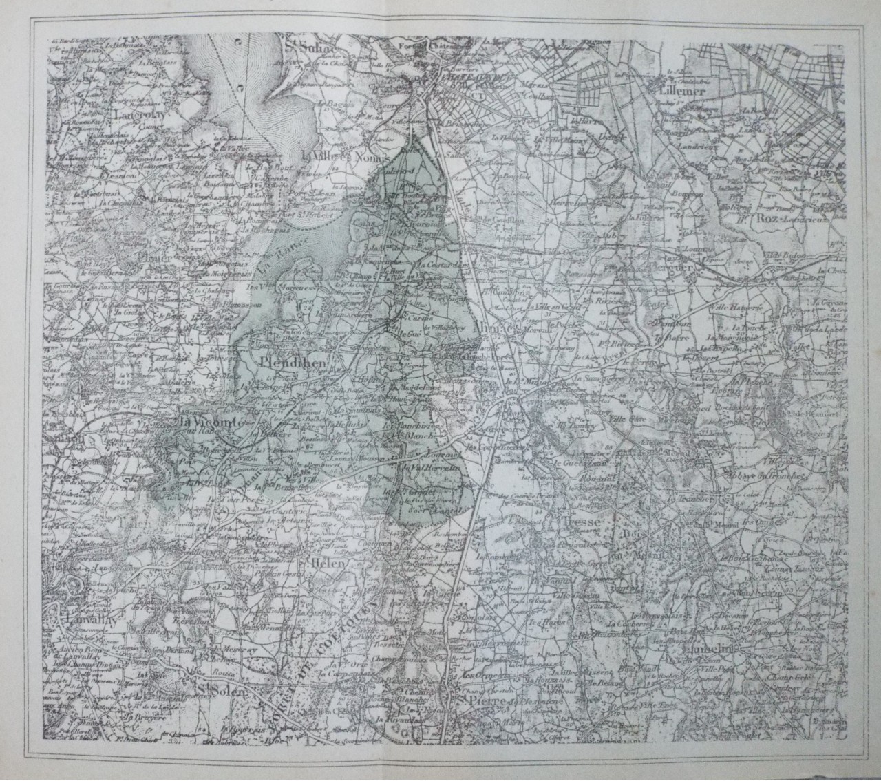
Carte de Pleudihen et des Environs
Ref: P/31618
Region: Pleudihen
Type: Lithograph
Date: 1916

Not for sale
91%
Departements et Districts de Normandie et du Maine Perche.
Ref: P/31548
Region: Ille et Vilaine
Type: Copper

91%
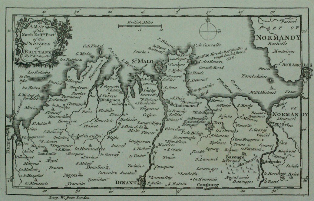
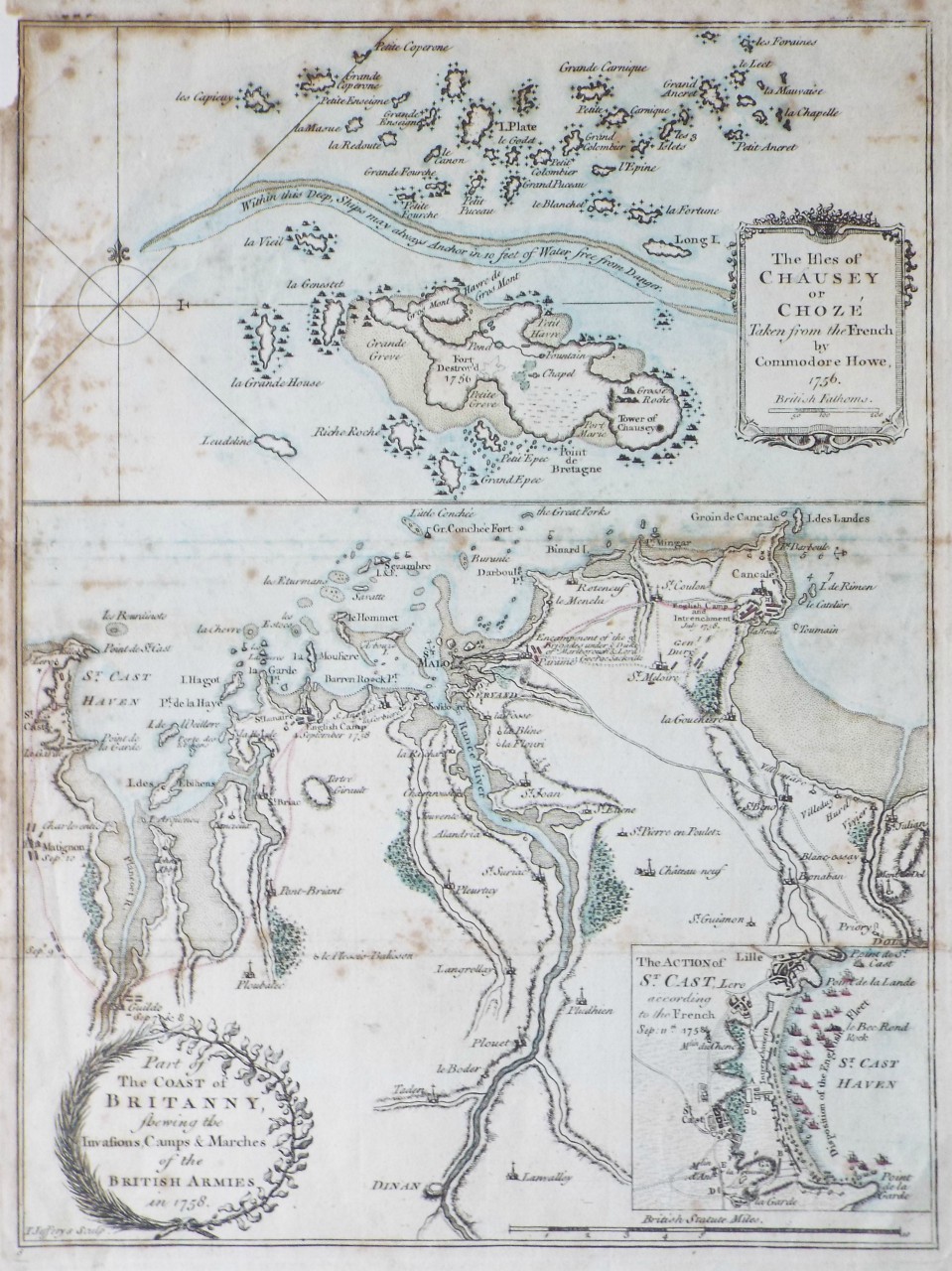
Part of the Coast of Britanny, shewing the Invasions, Camps & Marches of the British Armies in 1758. The Isles of Chausey or Choze Taken from the French by Commodore Howe, 1756
Ref: P/23380
Region: Saint-Malo
Type: Copper
Engraver: Jefferys T

Not for sale
91%
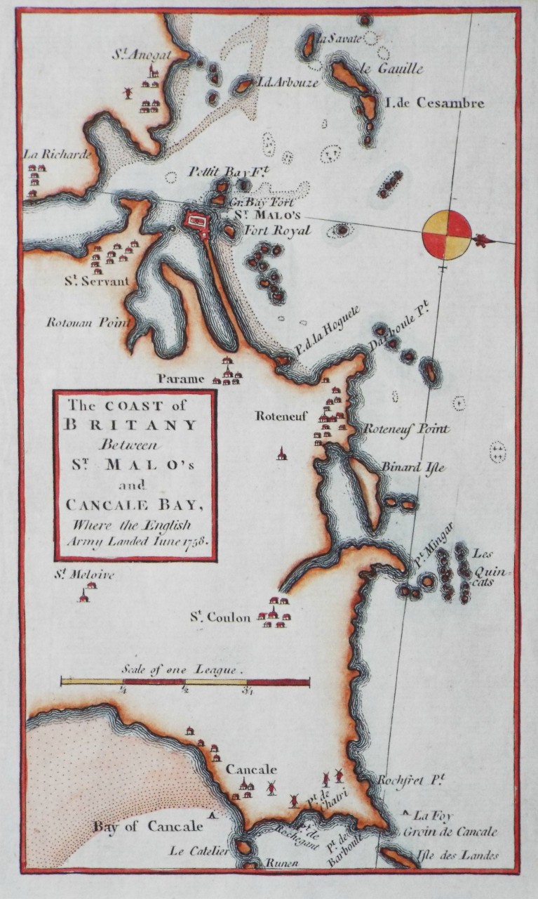
The Coast of Britany Between St. Malo's and Concale Bay, Where the English Army Landed June 1758.
Ref: P/24069
Region: Saint-Malo
Type: Copper
Date: 1758

Not for sale
91%
A Plan of the Harbour of Brest
Ref: P/11368
Region: Brest
Type: Copper
Cartographer: Kitchin T
Engraver: Kitchin T
Publisher: R Baldwin
Date: 1760


Displaying 10 to 20 of 88